FAQs
- narrow spaces that open to the sky – pedestrians remain in touch with the changes in environment and activities in the city;
- fine grain – their scale offering an intensity not experienced in city streets;
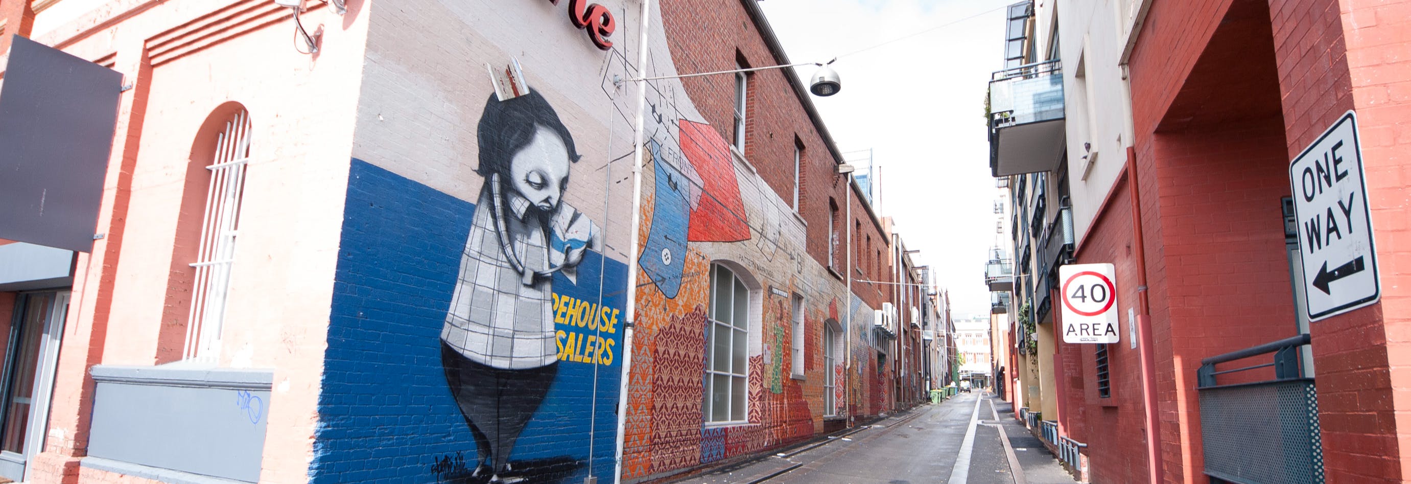
- undeniably gritty – offering a glimpse of the city's industrial and commercial past;
- good connectivity and permeability – laneways offer convenient short cuts through the city grid;
- quirky areas which, being unfamiliar, offer an element of surprise and discovery.
- Physical environment: Overall quality and amenity including lighting and public art.
- Adjoining lot configuration: edge condition including built form and potential to engage with the laneway.
- Landuse and catchment: adjacent landuse and people in the laneway’s primary catchment.
- Complementary business activity: Level of business activity near the laneway.
- Connectivity: Laneway’s role in providing pedestrian connection.
- Vehicle access and servicing: Management of service operations.
What is a laneway?
For the purposes of this document laneways are defined as access ways which are secondary to main streets within the city. They may also be known as right of ways. They are primarily open to the sky and enclosed by buildings on both sides. Ownership may be public, private or a combination of both.
What is the study area for this report?
The study area encompasses Northbridge and Central Perth. Pedestrian activity is most concentrated in the retail core with William Street acting as the central spine between the bus and train stations. Of the 67 laneways in the study area only 19 are owned (or part owned) by the City of Perth with many of them located in heritage areas.

Why are laneways important?
Laneways are integral to the way the whole city operates each day. Bins can be stored, collected, vehicles parked, and shops can be serviced via these tiny spaces without compromising the functions of the adjacent main streets.
Regardless of their historic and current functions, laneways share many of the following features:
These unique features make them ideal spaces to bring creativity, fun and much needed activation in throughout Central Perth and Northbridge.

How are laneways classified?
The classification system has been developed to understand which laneways have the greatest propensity for change and should be prioritised for investment. Each laneway was assessed according to the following criteria:
What is the purpose of the Forgotten Spaces document?
The Forgotten Spaces document sets out the City’s high-level aspirations for revitalising Perth’s laneways with a focus on maximising its contribution to Perth’s on-going development as a highly liveable, prosperous, and sustainable city.
Why should we focus on laneways?
Laneways are the workhorses of the city that ensure waste removal, and other back-of-house services can be performed without compromising the functions of the adjacent city streets. These functions need to be protected. Some laneways in Central Perth and Northbridge are key pedestrian links and others are destinations drawing crowds to their small bars and to view street art.
Why is there a focus on City of Perth owned laneways?
The laneways in City of Perth ownership are generally in strategically located places where there is a high concentration of pedestrians in nearby streets. As the public realm is in City ownership this also enables the City to undertake upgrades including the installation of lighting and surface treatments.
What are the recommendations?
The vision for continuing to revitalise key laneways will be realised by:
• Enhancing safety in privately owned laneways by encouraging the installation of lighting.
• Continuing to upgrade (or refresh) the public realm in City owned laneways.
• Ensuring new developments in laneways positively contribute to the space.
• Supporting small scaled events and business through grants and sponsorship.
• Commissioning additional public art as part of a wider art trail.
• Protecting the existing physical form and function.
• Developing a Public Art Framework to guide our future public art programs including temporary works.
• Enhancing wayfinding by giving laneways official names.
• Using laneways to showcase the ‘City of Light’.
• Signposting them as slow speed shared spaces that everyone can enjoy.
• Investigating the feasibility of permit walls to allow local artists to express themselves for free.
